
Rest Your Legs. Refuel Your Spirit.
Hostel & Campground at the Edge of Grayson Highlands
Your basecamp for exploring everything Grayson Highlands has to offer — including Mt. Rogers, Whitetop Mountain, and the famous feral ponies just 6 miles from the park. Bunks, glamping, tent camping, RV sites, gear rentals, shuttles, and genuine trail hospitality from thru-hikers with 5,000+ miles on the AT.
07/17/2026 Update: The Forest Service announced today that the full Virginia Creeper Trail will reopen on March 31, 2027, giving the repaired trail time to settle over the winter. When the Creeper Trail reopens, the Appalachian Trail (A.T.) detour outlined below will not longer be in affect, and hikers can proceed along the normal route of the A.T. north of Damascus. — Updated on 05/11/2026 Construction work to rebuild the Virginia Creeper National Recreation Trail (Creeper Trail) is underway. The trail was heavily damaged by Hurricane Helene in the fall of 2024 and extensive work is needed to repair the path and trestle bridges that were destroyed in the storm. The Appalachian Trail (A.T.) is co-aligned with or closely parallels the Creeper Trail for several miles north of Damascus. The U.S. Forest Service has closed the A.T. from Highway 58 at Straight Branch to Grassy Ridge Road/VA 859 (NOBO miles 476.6 to 485.8). Hikers must stay out of closed area for their safety and the safety of crews working. Construction is expected to last one year. Additional construction-related closures include: Straight Branch Trailhead (NOBO mile 476.6) Creek Junction Trailhead (NOBO mile 484.6) The Creeper Trail from Trestle 16 in the Town of Damascus to the North Carolina state line just past Whitetop Station. Non-A.T. closures: Whitetop Laurel Fishing Trail (FST 4645), Taylors Valley Spur (FST 465), Whitetop Station Parking Lot & Trailhead, and Green Cove Parking Lot & Facility. A.T. hikers have two options to continue their journey until construction is done, listed below. Both options are acceptable for the ATC’s 2,000-miler program. Note that we do not recommend hikers walk Grassy Ridge Road/Highway 58 to or from town. Both are narrow roads with no shoulder and tight corners. High 58 currently has heavy construction traffic day and night. Option A: Detour around the closed section on the Iron Mountain Trail, Flat Top Trail, and Mt. Rogers Trail. See the map at the bottom of this post. This temporary detour will be signed and is shown in the map below. It is also in FarOut – be sure you’ve updated all waypoint data for the Southern Virginia map. The detour is the best option for hikers who want a continuous walking route. The Iron Mountain Trail was the route of the A.T. until 1972, so taking the detour is a also fun way to retro blaze! Total Detour Length: 20.9 miles (temporarily routing around 22.8 A.T. miles, including the closed section). Important notes for hikers about this detour: Wear blaze orange as hunting is popular along the Iron Mountain Trail, including hunting with the use of dogs. Sections of the Iron Mountain Trail are multi-use. Stay alert and share the trail. Mountain bikes and horses are allowed in some areas. Motorized use is allowed on some sections. We highly recommend getting an updated paper map of this area. You can purchase maps through our online store or at local outfitters in Damascus. NOBO (northbound) Directions: Continue northbound on the A.T. from Highway 58 up the steps and into the woods. In 2.5 miles, take the blue-blazed Iron Mountain Spur Trail left uphill. Follow the spur trail for 0.2 mile until you come to the yellow-blazed Iron Mountain Trail. Turn right, and follow the Iron Mountain Trail for a total of 15.3 miles. You’ll pass several other side trails along the way that lead to different campgrounds and roads within the Mt. Rogers National Recreation Area. The Iron Mountain Trail also follows several roads/old woods roads at different points. Be sure to follow the signs marking the detour route and pay attention at intersections. There are two historic A.T. shelters and one campsite along the Iron Mountain Trail that have reliable water sources and are still available for camping. The following overnight sites are listed from south to north from the Iron Mountain Spur Trail: Sandy Flats Campsite at mile 4.8 Straight Branch Shelter at mile 9.7 Cherry Tree Shelter at mile 15.3 At Cherry Tree Shelter, bear right (south) onto the blue-blazed Flat Top Trail and follow it for 1.7 miles to the Fairwood Valley parking area. Follow the signs marking the detour. Portions of the Flat Top Trail follow a gravel roadbed. Walk through the gravel parking area to VA 603, a paved state highway. Cross VA 603 diagonally and turn left onto the Mt. Rogers Trail boardwalk. Follow Mount Rogers Trail 3.9 miles, passing a junction with the Lewis Fork Spur Trail at 2.1 miles. The Mt. Rogers Trail is blazed blue. The Mount Rogers Trail terminates at the A.T. Stay left to continue northbound. Thomas Knob Shelter is 2 miles further. SOBO (southbound Directions: 2.1 miles south of Thomas Knob Shelter, turn right onto the Mt. Rogers Trail (blue blazed). Follow it for 3.9 miles down to VA 603. Cross the paved VA 603 and walk through the gravel parking area to the Flat Top Trail, marked with blue blazes. Follow the Flat Top Trail for 1.7 miles until you get to Cherry Tree Shelter. At the shelter, turn left onto the yellow-blazed Iron Mtn Trail. You’ll follow the Iron Mtn Trail for a total of 15.3 miles. You’ll pass several other side trails along the way that lead to different campgrounds and roads within the Mt. Rogers National Recreation Area. The Iron Mountain Trail also follows several roads/old woods roads at different points. Be sure to follow the signs marking the detour route and pay attention at intersections. Besides Cherry Tree, there is one other historic A.T. shelter and one campsite along the Iron Mountain Trail that have reliable water sources and are still available for camping. From south to north from Cherry Tree Shelter: Straight Branch Shelter at mile 5.6; Sandy Flats Campsite at mile 10.5; Continue on the Iron Mountain Trail until you reach the Iron Mountain Spur Trail on the left. The spur trail connects to the A.T. in 0.2 miles. When you reach the A.T., turn right to continue on the A.T. southbound toward Damascus. Highway 58 is 2.5 farther. Option B: Get a shuttle to/from Damascus and Grassy Ridge Road/VA-859. Grassy Ridge Road is the northern boundary of the construction closure at NOBO mile 485.8. NOBO hikers can pick-up the A.T. from here. SOBOs can get picked up and head into town from here. This is the best option for hikers who want to miss as little of the A.T. as possible. Note that Grassy Ridge Road is a narrow dirt road with no parking. SOBOs: There is no cell reception at Grassy Ridge Road, so make shuttle plans in advance. There are several local shuttlers in Damascus and the surrounding area. Visit our Damascus Trail Center or local outfitters for more information, or consult an updated guidebook or FarOut. Click the image for a larger, printable version.
04/21/2026 Update: Bailey Gap Shelter is closed due to bear activity (NOBO mile 660.9). Hikers should avoid this shelter and camping area, including not stopping here to eat lunch or take a break. Respecting bear-related closures like this one give bears the chance to seek natural food sources and revert back to wild behavior. Keep in mind that bears can roam 20-40 miles a day in search of food. Practice good bear safety and use a bear canister no matter where you camp on the A.T. — 04/20/2026 The ATC received a report of a food-conditioned bear at Bailey Gap Shelter (NOBO mile 660.9) that showed very little fear of humans, despite being yelled at and hikers trying to drive it off. The bear got food from an improper PCT-style food hang and punctured holes in three Ursacks. You can protect yourself, other hikers, and the bears by: Educating yourself on bear safety and proper food storage before leaving for the Trail. Exercising caution in areas with frequent bear activity. Properly storing all food, trash, and scented items at night in a bear canister. Never sleep with your food or trash. Keeping a clean camp by picking up crumbs and cleaning up spills. Packing out all trash and food waste. Never leaving unsecured food unattended – even for a moment such as a quick trip to the privy or to check out a view. Using a bear canister. Hard-sided bear canisters are the most reliable method of food storage on the A.T. Please report bear encounters on the A.T. using our Bear Encounter Report form. Early intervention when there’s a bear becoming habituated to humans protects hikers and the bears.
04/29/2026 Update: The parking lot is closed as of today and will likely be closed for approximately 30 days. — 04/23/2026 The Appalachian Trail (A.T.) parking lot on the north side of Manassas Gap off Tucker Lane/VA-725 will be closed for several weeks starting next week in late April into May for renovations. The A.T. in the area will remain open. The parking area off VA-55 will remain open and is a good alternative (this lot is just south along Tucker Lane, right across from where Tucker Lane intersects with VA-55). Hikers and visitors should follow all instructions from posted signs and crews. Stay out of the work zone for your safety and the safety of crews working.
Where You'll Stay
Comfortable accommodations for hikers, campers, and travelers along the Appalachian Trail. All guests enjoy hostel amenities including heated shower, rec room, party deck, and Cabin Creek access — sit and dangle your feet in the water, swim, or sit on a swing watching the trout swim and the water float by. Please note: we have goats, chickens, dogs, and cats on the property — our animals are friendly, but we want all guests to feel comfortable.
See every option and what it costs
Bunkhouse
$50/night
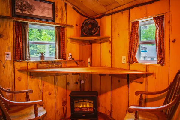
Heated and electric indoor shelter for thru-hikers and backpackers. Just a warm, clean bed after a long day on the trail.
- Sleeps 4
- Heated & personal electric
- Hostel Amenities
- Starlink WiFi

Glamping Yurt
$120/night
16' x 16' yurt that is entirely your own — a full size bunk bed with a twin on top, your own deck, grill and fire pit, personal electric, mini fridge and Keurig.
- Sleeps 4
- Private deck, grill & fire pit
- Mini fridge & Keurig
- Hostel Amenities

Glamping Tent
$80/night
10' x 18' tent with a clean queen size bed and an added bunk, sleeping three. Personal electric included.
- Sleeps 3
- Queen bed plus a bunk
- Personal electric
- Hostel Amenities

Tent Sites
$25/night
Six creek-side sites for setting up your own tent. Bring your gear and enjoy full access to hostel amenities including shower, rec room, and party deck.
- Bring your own tent
- Six sites available
- Shower access
- Creek-side

Car Camping
$25/night
Three spots on the bank of Cabin Creek to park and sleep in your own vehicle. No power or bins down there, but Starlink reaches and the heated shower is across the street.
- Sleep in your vehicle
- Three creek-side spots
- Starlink WiFi reaches
- Heated shower included
Trail Services
With over 5,000 miles on the Appalachian Trail, we know what hikers need. From gear rentals to shuttle rides, we've got you covered.
Equipment Rentals
Full Pack from $300/2 nights
Hit the trail fully equipped without the gear investment. Rent a complete backpacking setup or individual items.
- Backpack & tent
- Sleeping bag
- Cook stove & filter
- Half price 2nd item
Trail Shuttles
AT & Grayson Highlands
Reliable transportation to trailheads. Skip the road walk and start your adventure where you want.
- Massey Gap & Elk Garden
- Flexible scheduling
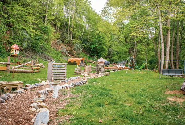
Hostel Amenities
Relax & Recharge
Everything you need to rest up. Creek-side relaxation with all the essentials covered.
- Starlink WiFi
- Party deck on Cabin Creek


Get In Touch
Questions about availability, shuttles, or need a ride from town?
Call Us
Questions about availability, shuttles, or need directions? Give us a call anytime.
Email Us
Reservations, group bookings, or general inquiries. We'll get back to you within 24 hours.
Find Us
Highway 58 (The Crooked Road), Whitetop, VA. Easy access for AT hikers and Grayson Highlands visitors.
Send a Message
Fill out our contact form and we'll get back to you within 24 hours.
Jeff Davises Hostel & Campground
10425 Highlands Parkway, Mouth of Wilson, VA 24363
Near Grayson Highlands State Park & the Appalachian Trail
Walk-ins welcome! Reservations recommended during thru-hiker season (March–June).
Trail News

Where to Camp Near Grayson Highlands While the Creeper Trail Is Rebuilt
September 2026
The upper Virginia Creeper Trail is closed until March 2027, but everything else here is open. A practical rundown of where to camp near Grayson Highlands and Whitetop in the meantime.
Read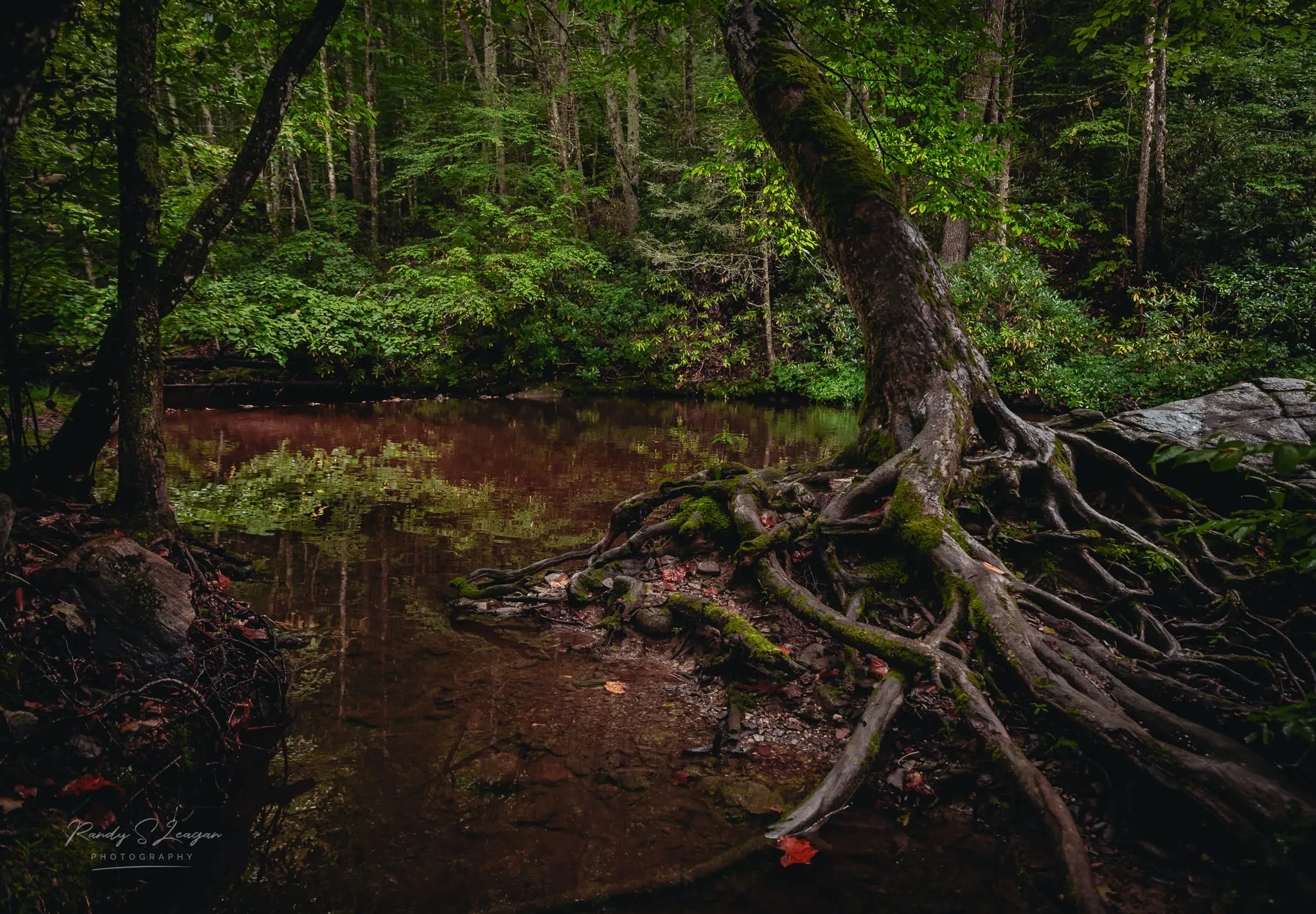
Trout Fishing Cabin Creek: Rainbow, Brown and Brook Trout at the Bottom of the Field
August 2026
There's a hundred yards of trout water running through the property. What's in it, when it fishes well, what you need to fish it legally, and why it's the most underrated thing we've got.
Read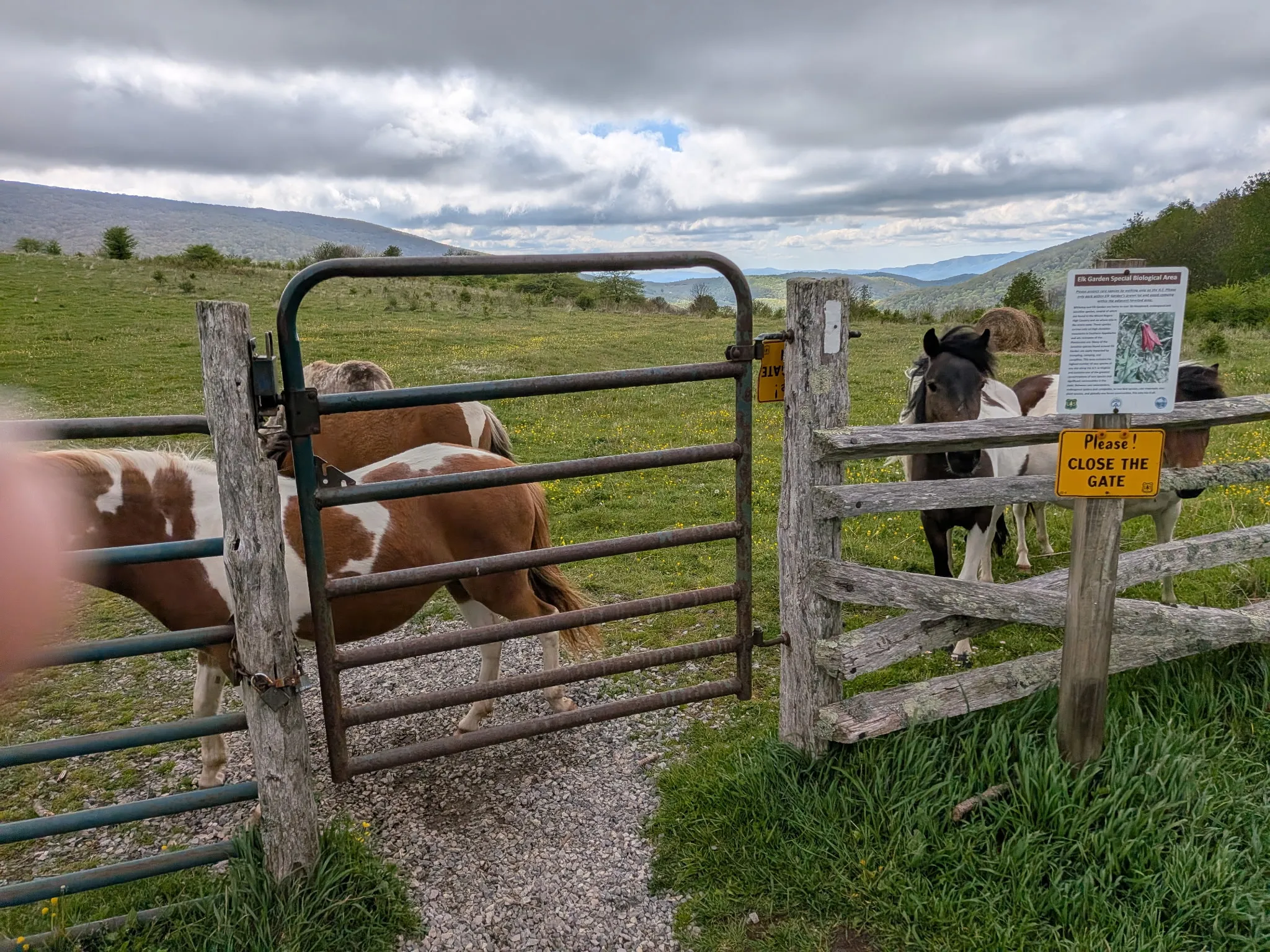
AT Shelters Near Mount Rogers: Thomas Knob, Wise, Old Orchard, Trimpi and Lost Mountain
August 2026
The Appalachian Trail shelters around Mount Rogers and Grayson Highlands, what each one is good for, and how to plan a section that doesn't leave you walking after dark.
Read